The new $300 million Tuktoyaktuk highway, which opened in 2017, provides a link between Inuvik and Tuktoyaktuk all-year-round. The Tuktoyaktuk road stretches for 140 kilometres of frozen Arctic tundra and connects the Atlantic, Pacific and Arctic Oceans.
How will the Tuktoyaktuk highway change the lives of the people who live in this remote community?
Tuktoyaktuk Winter Road
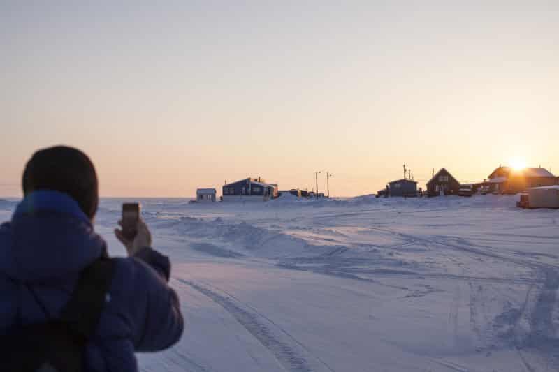
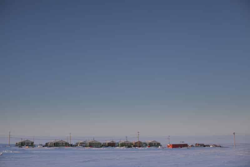
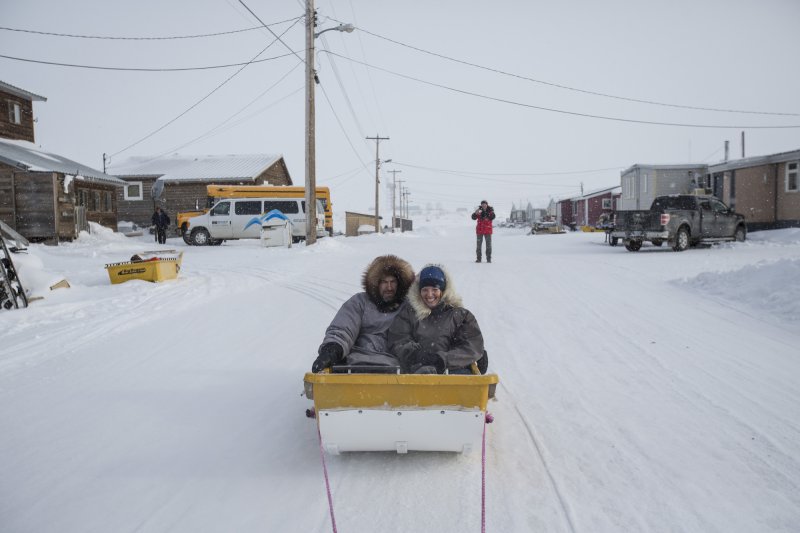
For residents of Tuktoyaktuk (“Tuk” as the locals call it), winter was the one time of year when they could drive from their isolated hamlet of nearly 900 people to the town of Inuvik about 190 kilometres away.
In the past, in summer, Tuktoyaktuk was only accessible by boat and plane, but every winter, as soon as the weather is cold enough, crews started building the ice road.
The Tuktoyaktuk Winter Road travelled across the frozen channels of the Mackenzie River delta and the Arctic Ocean from Inuvik to Tuktoyaktuk.
From January to April each year, people drove from Tuktoyaktuk to visit family and friends in Inuvik and Whitehorse (check out these things to do in Whitehorse) and go shopping.
In Tuktoyaktuk, being connected to the rest of the Northwest Territories year-round will open up a whole new world of possibilities for both the locals and visitors keen on exploring this remote area.
Things to do in Tuktoyaktuk
1- Watch the reindeer herd crossing the road
On a Sunday morning in late March, cars begin arriving at a section of the Tuktoyaktuk road about two hours from Inuvik.
By lunchtime, dozens of cars are parked on either side of the road and about 200 people are lining the tops of the snow banks.
Their eyes are scanning the horizon.
Suddenly, a murmur runs through the crowd.
“They’re coming! They’re coming!” people say, pointing.
A massive herd of about 3,000 semi-domesticated reindeer appear over the crest of a hill and begin moving like a choreographed ballet.
Behind them, a Saami herder dressed in his traditional gakti and straddling a snowmobile keeps them moving.
“Go! Go!” he urges them on until they cross the ice road and disappear from view.
Every spring, the herd crosses the road as they move from their winter grounds to their summer grazing area on nearby Richards Island.
2- Check out the ice patterns on the road
After watching the reindeer crossing, I stand on the ice road and look at the patterns that cracks in the blue ice create beneath my feet.
This road was featured in the reality television series Ice Road Truckers in 2008.
The road is surprisingly smooth, although I walk gingerly back to the car to avoid tumbling on the slippery surface.
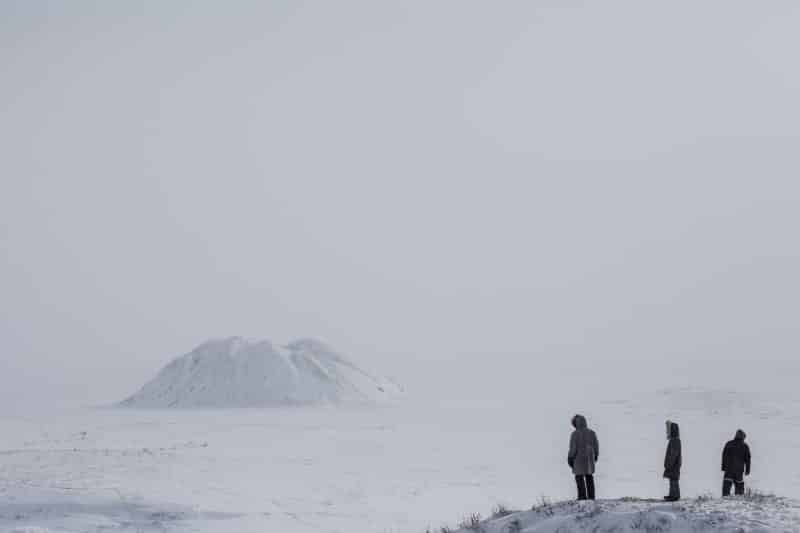
3- Visit the Pingo Canadian Landmark
About five kilometres west of the community, ice-covered hills rise above the Arctic tundra landscape.
Pingos are created from the permafrost heaving upwards like giant muffins, thanks to the ground’s annual cycle of freezing and thawing.
The Pingo Canadian Landmark is home to eight of the area’s 1350 pingos.
This includes Ibyuk, the world’s second tallest pingo.
At 160 feet, it’s the height of a 16-storey office tower.
The local Inuvialuit people have long used these hills as navigational landmarks as well as a place from which to scout the area for wild game and whales.
In fact, the term “pingo” is derived from the word “pingu” – which means hill in the Inuvialuktun language.
4- See the Lady of Lourdes schooner
In town, go on a tour to see some of the village’s buildings and the historic Lady of Lourdes schooner.
The schooner travelled the Beaufort Sea in the 1930s and 1940s delivering supplies to Catholic missions from Cambridge Bay to Tuk.
5- Dip your toe in the Arctic Ocean
If you’re feeling especially brave (or perhaps a bit foolish), you can dip your toe into the freezing Arctic Ocean.
This is a task better undertaken in July when the water is warmer.
6- Check out the golf ball
Wondering what’s with the big golf ball on the landscape?
During the Cold War of the 1950s, it was one of a series of radar domes that were installed as part of the Distant Early Warning Line (DEW Line) to keep an eye on air traffic and possible Soviet incursions.
7- Explore the underground Community Ice House
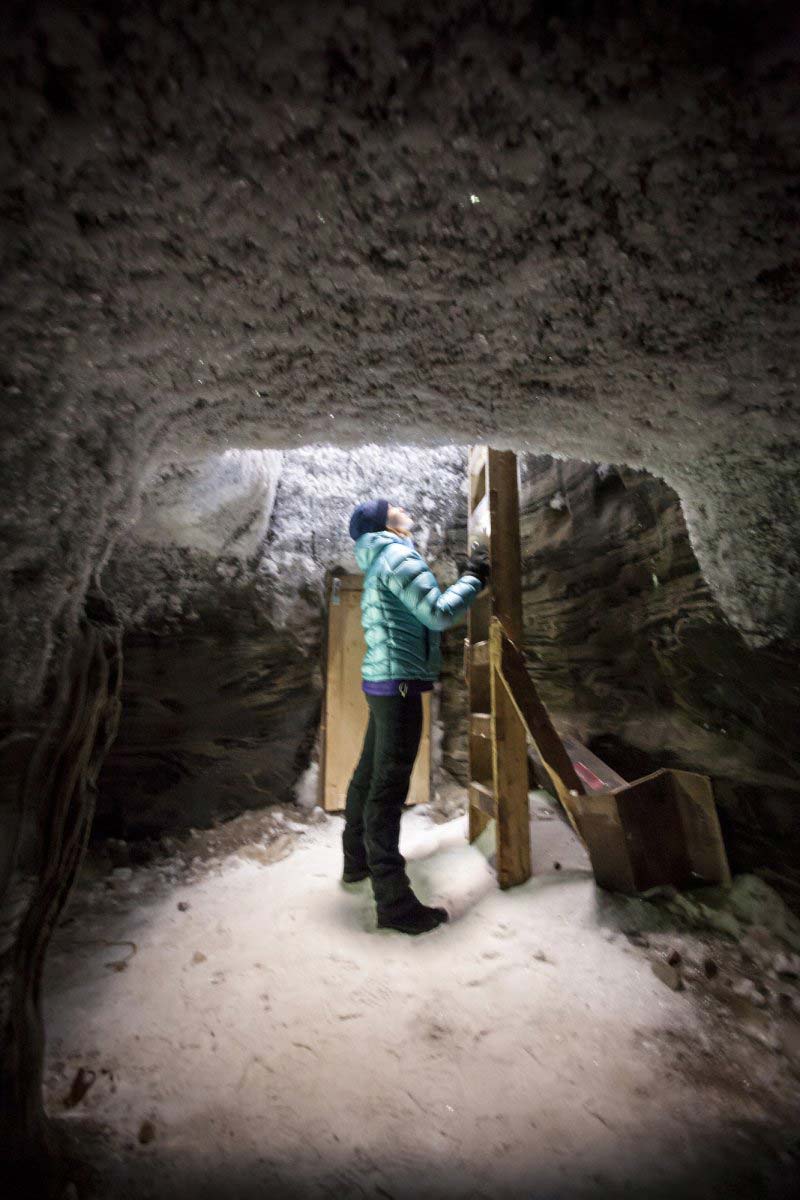
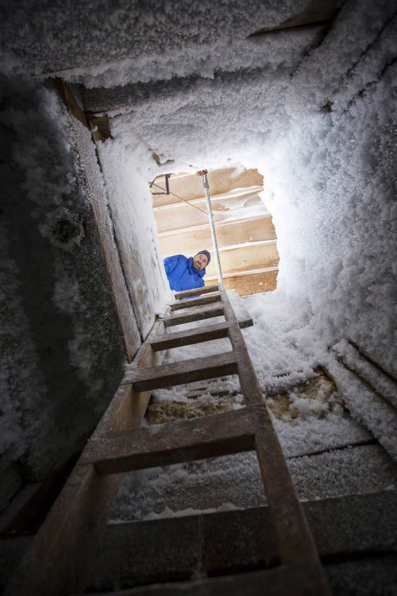
One of the hamlet’s most prominent attractions is Tuktoyaktuk’s underground Community Ice House.
Steen lifts the wooden door at the top of the freezer and visitors peer into the darkness before climbing down the icy rungs of a 30-foot wooden ladder.
Just when you wonder if you’re heading down a rabbit hole, your feet hit the ground.
Turn on your headlamp and start exploring the numbered rooms that line three hallways.
The icehouse was dug into the permafrost as a place where local residents could store food.
The Inuvialuit people have been harvesting caribou and beluga whale here for generations.
Tuk means “looks like a caribou” in Inuvialuktun, the language of the local Inuvialuit people (the Western Arctic’s Inuit).
These days, residents ice fish in April, hunt geese in May and June, and then whales in August.
But with the introduction of modern freezers, the rooms that once housed the community’s food are mostly empty now.
Layered ice formations on the walls look like pieces of art.
After wandering around, return to the base of the ladder and trek back up to the surface.
Read these posts about visiting the Northwest Territories:
How to see the Yellowknife Northern Lights
7 Wonders of the Northwest Territories
3 Remote Northwest Territories National Parks

Plan Your Trip

Rent A Car – Find the best car rental rates at Discover Cars. They compare car hire companies to provide you with the best deal right now.

Find A Hotel – If you’re curious about this article and are looking for somewhere to stay, take a look at these amazing hotels.


