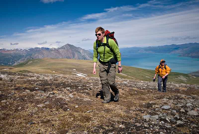
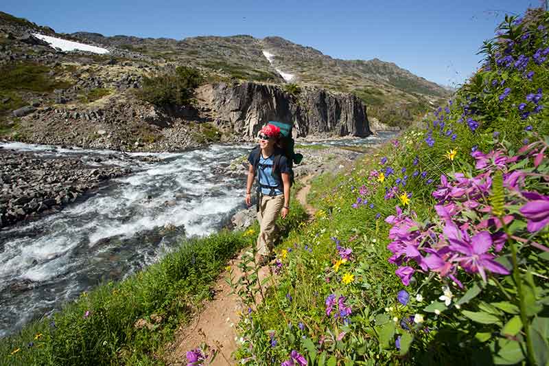
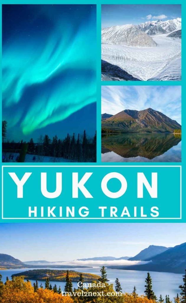
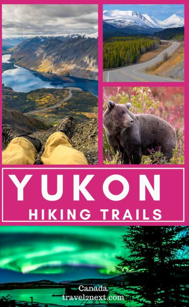
Canada’s Yukon Territory is a dream destination for hikers, with vast wilderness areas to explore. Highlights are the historic Chilkoot Trail, Kluane National Park and Tombstone Territorial Park. With breathtaking panoramic landscapes of mountains and rivers, hiking in the Yukon is exceptional. Yukon hiking trails are among the best in the world and there’s a walk to suit all levels of fitness, from casual rambler to experienced trekker.
Not only is the Yukon’s wilderness home to an array of wildlife, such as caribou, moose, grizzly bears and Dall sheep, hiking in the Yukon is filled with historical wonders. Exploring the wilderness is a chance to discover the history of the First Nations people and the Klondike Gold Rush stampeders who endured hardships along the Chilkoot Trail to get to Dawson City in the 19th century.
With three national parks – Kluane National Park, Ivvavik National Park and Vuntut National Park – and eight territorial parks, the Yukon has an abundance of wilderness to explore on foot.
Are you feeling inspired? This Yukon hiking guide will help you plan your next Yukon hiking trip.
Yukon Hiking Guide
National Parks in Yukon
Kluane National Park
Home to Mount Logan (5959m), Canada’s highest peak, Kluane National Park also has the country’s largest ice field and St Elias Mountain Range is the highest coastal range in the world.
Besides being home to a population of North America’s most genetically diverse grizzly bears, you might also see Dall sheep, mountain goat, moose and birds.
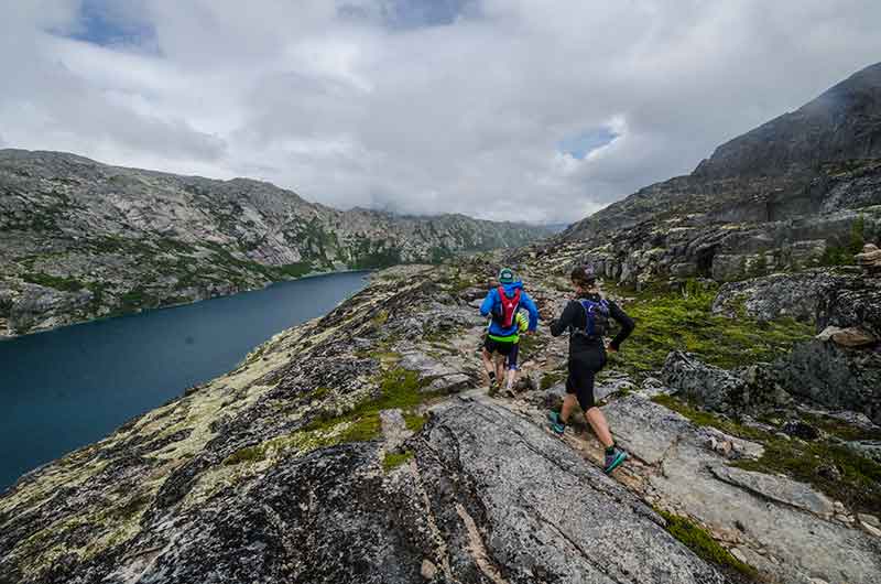
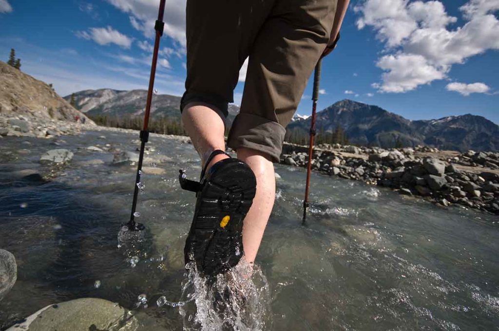
Kluane offers excellent hiking through alpine passes, past glaciers, scrambling over boulders and climbing St Elias Mountain Range.
One of the advantages of Kluane National Park is awe-inspiring mountain scenery is easy to enjoy, even if you are not experienced at hiking.
Sprawling over 20,000 square kilometres of mountainous wilderness, this national park has fantastic day hikes and stunning scenery to see by the side of the highway.
As it covers a vast area, where do you start?
To better understand the park, it’s worth visiting the two visitor’s centres, Kluane National Park and Reserve Visitor Centre in Haines Junction and at Thechàl Dhâl Visitor Centre.
You’ll find exhibits, recordings of First Nation elders telling stories, cultural artefacts, and 3-D geographic models.
Below are some hiking trails you might like to try or follow this Kluane hiking itinerary.
St Elias Lake Trail
This trail is an easy day hike suitable for families along an old recreation road connecting the Haines Highway to a sub-alpine lake.
It starts hilly and winds its way through forests of spruce and aspen before descending into a sub-alpine valley of dwarf birch and willow.
A lovely time to visit is in spring or summer when wildflowers are in bloom and there’s a chance of spotting moose, beavers, loons and mountain goats.
The trailhead is on the Haines Highway, 60 km (37 mi) to the south of Haines Junction. The hike is a 7.6km return hike that takes between two and four hours.
Kokanee Trail
Following the shore of the lake, the trail passes interpretive signs with interesting facts about the Kokanee salmon in the lake and benches to sit and enjoy the view along the way.
At the end of the boardwalk, the walking trail continues along the shore to spectacular views of the lake and mountains.
The trailhead starts from the Kathleen Lake day-use area and the 1km hike is an easy walk.
Cottonwood Trail
The 83km Cottonwood Trail is one of the most famous Yukon hiking trails.
Look out for tell-tale signs of bear activity in the area, such as sap oozing from a divot in a tree (where a bear has scratched itself), berry-spotted manure and claw marks embedded in tree trunks.
With only 250 grizzly bears and 150 black bears in Kluane National Park – that is one bear per every 20sq km – the chances of bumping into a bear are slim and fortunately, bears are shy.
Bears have a heightened sense of smell, but their eyesight is poor.
If you are hiking in the Yukon, make sure to brush up on how to handle bear habits in case you come across one in the wilderness.
A day hike on the Cottonwood Trail is a hike under Cottonwood and Aspen poplars. Then a narrow track leads to a gap at the lake offering jaw-dropping vistas.
The “V”-shaped valley is a picturesque landscape of dramatic, rugged peaks of the St Elias Mountain Range.
Horizontal spruce trees protrude from shale, pushed over by a rock glacier, which is a unique landform where rock and ice move down a slope pushing the trees over.
Interestingly, scientists predict in about 300 years this moving landscape will end up in the lake.
The trailheads are at the Kathleen Lake day-use area and Mush Lake Road. Both are on the Haines Highway to the south of Haines Junction. The 85km loop takes four to six days.
Kings Throne Trail
Branch off the Cottonwood trailhead after 2 km on the old mining road and from the bottom of the mountain.
The trail rises through a forested area and veers to the left to continue up the King’s Throne trail, which emerges from the trees and zigzags up the mountain.
The marked trail ends at the throne but if you are a keen hiker, the steep climb to the peak is a challenge to conquer.
Your reward is the incredible view where, on a clear day, of Mount Alverstone, Mount Hubbard and Mount Kennedy.
Slim’s River West Trail
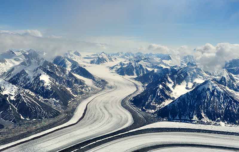
For a view of the Kaskawulsh Glacier, hike the Slim’s River on the west side to end up at a campsite at the glacier’s toe.
This is hiking into the heart of Kluane National Park, with impressive mountain scenery.
Make plans to camp for two nights to make sure you have enough time to get the best views of the glacier.
Ivvavik National Park
Formed because of a First Nations land claim agreement, Ivvavik National Park borders the Beaufort Sea (part of the Arctic Ocean) and is a calving ground for the Porcupine caribou herd.
The landscape of Yukon’s north offers natural vistas of mountains, valleys and plains with incredible wildlife.
As there are no marked trails, hiking in Ivvavik is an authentic wilderness experience using landmarks, such as hills, rivers, valleys and lakes as a guide.
Home to grizzly bears, wolves, foxes and caribou, Ivvavik means ‘a place for giving birth, a nursery,’ in the Inuvialuit language.
The best time to visit Ivvavik is from late June to early July, for wildflowers and caribou, although hiking season starts in mid-June and runs through to mid-August. And the autumn colours are stunning in late August.
The Ivavik Fly-in Base Camp, which has flushing toilets and hot showers, is a good base.
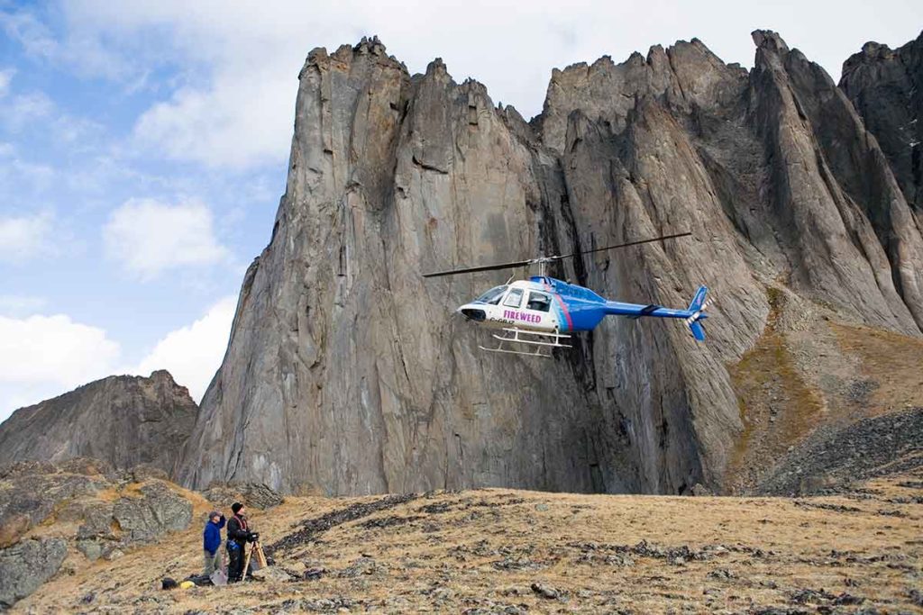
Parks Canada has five and nine-day guided hiking tours, which includes meals, camping equipment, national park fees and the flight from Inuvik.
Ivvavik National Park is remote, and access is by charter aircraft from Inuvik to Sheep Creek. Drive to Inuvik from Whitehorse via Dempster Highway or fly there with Air North via Dawson City.
Vuntut National Park
The least-visited national park in Canada, Vuntut National Park is an unspoiled Arctic wilderness that would appeal to serious hikers.
There are no services, facilities or marked trails.
So why would you go?
Well, Vuntut National Park is Canada’s equivalent of Africa’s Masai Mara.
It’s a nature’s wonderland home to moose, muskrat, wolves and grizzly bears.
Waterfowl flock to the shallow lakes of Old Crow in the hundreds of thousands and the Porcupine caribou herd annual migration is one of the largest of any land animal in the world.
The Vuntut Gwitchin people live in traditional ways – travelling, camping and hunting – on this land where there is 24-hour-a day sunshine in summer.
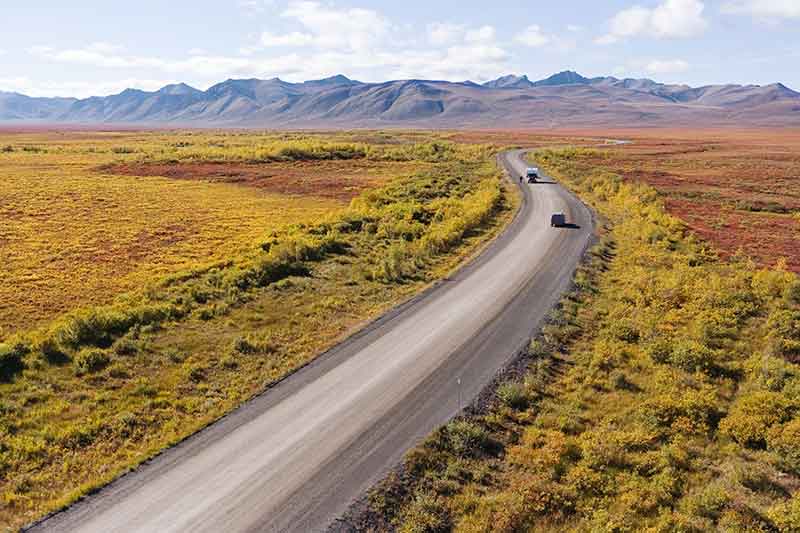
The closest road to Vuntut National Park is the Dempster Highway, which is still about 109 miles away. Air North flies between Whitehorse, Old Crow (31 miles from Vuntut), Dawson City and Inuvik a few times a week.
For more exciting attractions in Yukon read:
Territorial Parks
Of Yukon’s eight territorial parks and 12 habitat protection or special management areas, Tombstone Territorial Park is the most well-known.
Tombstone Territorial Park
If you’ve seen stunning scenery of soaring peaks in the Yukon, it’s most likely to have been photographed in Tombstone Territorial Park.
Tombstone Territorial Park is probably the most popular destination for hiking and camping in Yukon, with excellent opportunities for wildlife viewing.
There is one campground that you can reach by road (Tombstone Mountain) and backcountry campgrounds at Grizzly, Talus and Divide lakes.
The First Nations name for the park is Ddhäl Ch’èl Cha Nän, meaning “ragged mountain land”, and is as a legacy of the Tr’ ondëk Hwëch’in Land Claim Agreement.
The drive along Dempster Highway cuts through the park and past the tundra landscape, with opportunities to spot wildlife.
Tombstone Territorial Park has five trails suitable for day hikes, ranging from easy 1km interpretive trails to the six-hour Hart River Winter Road Trail.
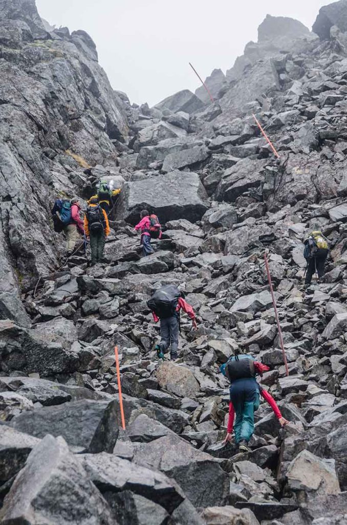
Hiking Tombstone’s backcountry is not a walk in the park and much of the terrain is steep, slippery, rocky and mountainous areas. There’s only one backcountry hiking route in Tombstone and three backcountry campgrounds. You’ll need good mapping skills.
Here are some hiking trails when visiting Tombstone Territorial Park:
Edge of the Arctic Interpretive Loop (Easy)
An easy 30-minute walk is excellent for kids and has fabulous views.
Beaver Pond Interpretive Trail (Easy)
The Beaver Pond Trail is a 1km trail on packed gravel surface and boardwalks suitable for wheelchairs.
From the Tombstone Interpretive Centre, the trail meanders past wetlands, beaver ponds and interpretive panels explaining the history and geology of the region.
Hart River Winter Road (easy to moderate)
Access the trail from a parking area on the Dempster Highway and hike along the valley floor past willow and dwarf birch, from North Fork Pass to an abandoned 1960s mineral exploration site.
A scenic time to walk is during autumn.
The area is a historic place for the Tr’ ondëk Hwëch’in First Nations to hunt caribou.
North Klondike Trail (moderate)
From the Tombstone Mountain Campground, the trail passes the North Klondike River and through a forest of poplar before rising to offer stunning valley and mountain views.
Look out for wildlife, such as moose and bears.
Goldensides Trail (moderate)
Hike through dwarf birch to the top of a shoulder.
Along the way, you’ll see incredible views and there are plenty of wildlife spotting opportunities.
Grizzly Creek to Mount Monolith Lookout (moderate to difficult)
This hiking trail takes about two hours one way and is a moderate to difficult hike, with boardwalks, stairs, slippery areas and rocks.
This trail has some serious uphill hiking and you’ll be rewarded with stunning views to Mount Monolith, Cairnes Valley and Grizzly Valley.
How to get there
The Tombstone Interpretive Centre on the Dempster Highway is a 1.5-hour drive from Dawson City.
Yukon Hiking Tips
1- Choose the right trail for your fitness level and one that is worthy of a reward.
2- Pack lightly and bring extra clothing, food and water as well as essential items for hiking such as a first aid kit, map, compass, whistle, bear spray, sunscreen and insect repellent.
3- As the Yukon is home to grizzly and black bears, be prepared for bear encounters by paying particular attention to bear safety, choosing trails with good visibility, carrying bear spray and learning to use it safely.
4- Make loud noises while hiking to keep the bears away.
5- If you’re camping out overnight, you’re required to pack your food in a bear canister, which you can rent from Information Centres within the parks.
6- Leave a copy of your itinerary with someone you know who raise the alarm if you fail to return when expected.
7- Dress in layers and choose synthetics or wool and break in a good quality pair of hiking boots and hiking shorts before you go.
8- Pack plenty of water and high energy snacks.
9- Register at the Tombstone Interpretive Centre and get the latest weather and wildlife information there.
This post was published in partnership with the Government of Yukon, Tourism and Culture.
Plan Your Trip

Rent A Car – Find the best car rental rates at Discover Cars. They compare car hire companies to provide you with the best deal right now.

Find A Hotel – If you’re curious about this article and are looking for somewhere to stay, take a look at these amazing hotels.


