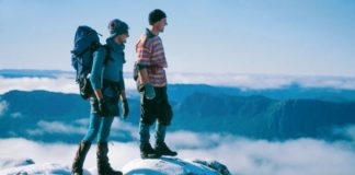
Freycinet National Park is possibly the most beautiful place in Tasmania and is undoubtedly the most photographed. It’s also a terrific place to go hiking as the views of Wineglass Bay are simply stunning.
Situated halfway down Tasmania’s east coast, Freycinet National Park is the oldest national park in Tasmania.
Freycinet became a National Park in 1916 and has been luring visitors to discover its spectacular pink granite mountains, sparkling bays and pristine forests.
Not a great deal has changed in Freycinet National Park since French explorer Louis de Freycinet discovered the park on the Freycinet Peninsula, making it an attractive back-to-nature destination.
For more Tasmania experiences read:
Contents
Freycinet National Park
By Christina Pfeiffer
As Freycinet National Park is the oldest national park in Tasmania, it has a reasonably well-developed infrastructure that includes a Visitor Centre, gift shop and outdoor theatre.
The stunning landscape of the Freycinet Peninsula can b described as two blocks of granite – The Hazards and Mt Graham/Mt Freycinet – connected by an isthmus of sand.
This landscape formed over 400 million years ago when the tectonic activity below the earth’s surface created a large granite mass right across Australia.
Freycinet National Park Camping
Located near Coles Bay, a 10-minute walk from the shops, Freycinet National Park Camping Ground has both powered and unpowered campsites available at different times of the year.
The beauty about camping here is that the campsites are a stones-throw from the edge of the ocean, the beaches are pristine and there are other facilities such as a Visitor’s Centre, which has a gift shop and an outdoor theatre.
The Discovery Ranger programme operates in summer, offering a range of activities that are especially great for kids.
Coles Bay is a lovely town with general stores where you can stock up on camping essentials like ice, gas bottles and also refuel your vehicle.
To camp in this national park, you’ll have to pay camping fees and for a Tasmanian National Parks Pass.
When to go camping in Freycinet National Park
Demand is high during the Easter and summer holidays when campsites are allocated via a ballot system, which is drawn in August.
Where to camp
Freycinet National Park has a campground consisting of a small coastal strip along the dunes at Richardsons Beach and Honeymoon Bay.
Here’s an overview of where to camp in Freycinet National Park:
Richardsons Beach
Richardson’s Beach has a dunes area and only fuel stoves can be used as campfires are not permitted.
Tent camping sites have access to tracks to the beach and are close to the toilet blocks, which has cold water and solar shower hooks.
Powered RV Sites in Freycinet National Park are suitable for caravans of up to 6m and are hardened to protect the coast.
The powered sites have easy access to the amenities block as well as potable water and greywater.
Disposal facilities are not available in Freycinet National Park but can be found in Bicheno or Swansea.
Honeymoon Bay
Honeymoon Bay only operates during the summer and over the Easter holidays.
The campsites are on a granite knoll with views of Honeymoon Bay and are a bit of a walk to the toilets.
Some sites require 4WD access.
Ranger Creek
Ranger Creek has facilities such as electric barbecues, picnic tables and toilets.
Toilets in Freycinet National Park
You’ll find public toilets at these locations:
- Honeymoon Bay
- Ranger Creek
- Wineglass Bay car park
How to book a campsite at Freycinet National Park
Each campsite can sleep up to six. Book a campsite at the Freycinet Visitor Centre (the minimum stay is 14 nights).
A ballot is drawn on the 1st August for campsites during the Easter holidays and from 18 December to 10 February, when the maximum stay is 10 nights.
Only one entry is allowed for each family group. For more information, go here.
Freycinet National Park Walks
There are a range of walks in Freycinet National Park, all with impossibly stunning views and there’s a good chance of spotting Tasmanian wildlife.
If you want to go for the big one, the 30km Freycinet Peninsula Circuit is the one to try.
Bushwalks to Wineglass Bay and the Freycinet Peninsula commence from the car park four kilometres away.
The Freycinet Visitors Centre is located at the entrance of the park and is open from 9 am to 5 pm daily.
1- Freycinet Peninsula Circuit
The Freycinet Peninsula Circuit is a 30km walk around the Hazard Mountains to Hazards Beach, then south to Cooks Beach and Bryans Beaches, crossing the heathland plateau and descending to Wineglass Bay.
Walking time: 2 days minimum (30 km)
2- Wineglas Bay Lookout Walk
The walk to the Wineglass Bay lookout is easy enough for most people to manage and is a walk everyone should do.
The view from the lookout is simply stunning and on a beautiful day, it’s better than the photos in the brochures.
Start at the carpark and climb 250 m between Mount Amos and Mount Mayson.
Walking time 1 hour 30 minutes (3km).
3- Wineglass Bay circuit
If you have a day to spare, this walk is worth tackling for its diversity of landscapes from dry eucalypt forest to the stunning Hazards Beach.
Along the way, the views of Great Oyster Bay and Coles Bay are breathtaking.
Not only will you get to see the iconic Wineglass Bay from the famous lookout, the highlight is swimming in Wineglass Bay and feeling the white sand between your toes.
Walking time: 4 to 5 hours (11km).
Freycinet National Park Kayaking
Multi-Day Kayaking Experience
By Louise Southerden
A wild peninsula with a spine of bare pink granite called the Hazards and more than 450 species of native vegetation (almost a third of Tasmania’s entire higher plant species), Freycinet is also famous for a certain beach on its east-facing coast: Wineglass Bay, a crescent of silica caressed by the cleanest water this side of the Pacific.
But there’s more to Freycinet National Park than Wineglass Bay as the Freycinet brothers, for whom the peninsula is named, found on their scientific expedition to the apple isle in 1801. And as we would find in our four days paddling the protected western side of the Freycinet Peninsula and beyond…
Sea kayaking always makes me think of Eskimos (I mean Inuits).
Sure their qayaqs were made of sealskin stretched over a wooden frame and attached using whale whiskers, and made-to-measure (their dimensions based on the paddler’s hip-width, height and girth).
But the basic idea hasn’t changed in centuries: stuff everything you need for the foreseeable into dry bags, stow it below decks and kiss terra firma goodbye.
At least for as long as your supplies last, which in our case was going to be (we hoped) five days.
Coles Bay to Hazards Beach
Day 1 finds us standing on a beach that wouldn’t look out of place in far north Queensland except for the fact that it’s in Coles Bay, two and a half hours’ drive north of Hobart.
Since most of us are beginners at the gentle art of paddling our own kayaks, we’re paying close attention to ex-river guide (on the Franklin, no less) Simon’s instructions.
Like the correct way to put on a “skirt” (neoprene bibs also called “spray decks” that fit around your waist and cover your cockpit so water can’t fill up the kayak), how to launch ourselves and come ashore and, most importantly for those of us in two-person kayaks, how to paddle in sync.
Simple enough, but it still feels too soon when we’re pointed towards the open ocean and given a shove that sends us wobbling into the bay.
For the first couple of hours we could be anywhere, what with all our concentration focussed on paddles and steering pedals.
But gradually our field of vision expands to take in the azure water lapping at our sides, sheer pink granite walls close enough to touch (the base of the 300-metre high Hazards Range) and a white-breasted sea eagle soaring overhead.
Simon drifts over – at least it seems that way, so effortlessly does he manoeuvre his single kayak – and we talk about what we see.
That’s when I realise the first thing about sea kayaking: it gives you time.
Time to wonder about what you’re looking at, to ask questions, to drift past something so close that you can touch it and to take it all in.
Why Kayak in Freycinet
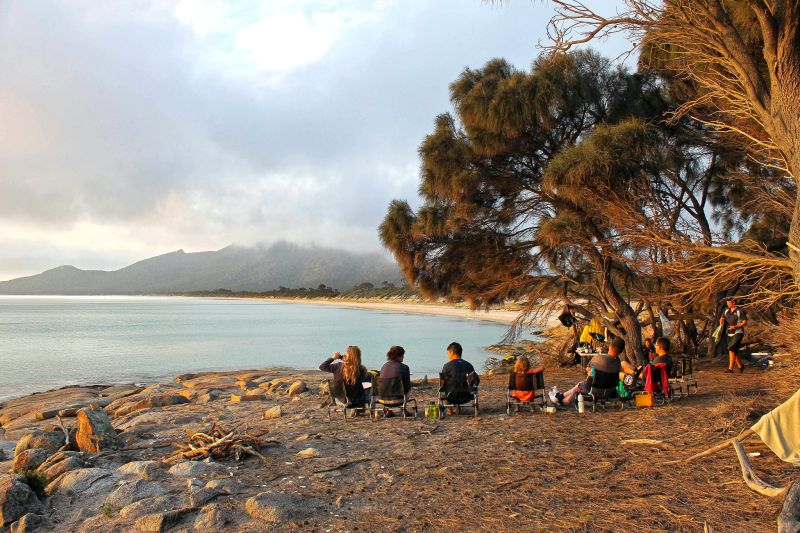
The second realisation comes that evening at our campsite on Hazards Beach as I watch the sea smooth itself out and gentle waves lick the heels of our boats (as the guides casually refer to the kayaks).
As my mind wanders over to where the kayaks are all strung together above the high tide mark (to prevent any of them from floating free in the night), it dawns on me that they’re more than our mode of transport for the next few days, more than just a means of getting from one idyllic beach campsite to the next.
The beauty of sea kayaking is that it lets you experience the beauty of your surroundings at close range.
In Freycinet, that means gliding over Fiji-green water before shushing onto glaringly-white sand, seeing airborne fish and dolphins metres from your bow or marvelling at the reflections of clouds in the water (in my paddle-dreamy state they remind me of a brand of bottled rainwater called Cloud Juice, from King Island in Bass Strait).
The rhythmic dipping of one paddle then the other – like bushwalking’s one foot in front of the other – is almost meditative, allowing you to tune in to your surroundings.
You’ve always got the freedom to get terrestrial any time you feel the urge to go for a walk on an empty beach or pitch your tent in a remote cove next to an Aboriginal midden.
Low Impact Travel in Freycinet
Most importantly, in an environment as pristine as Freycinet’s, sea kayaking is the epitome of low impact travel.
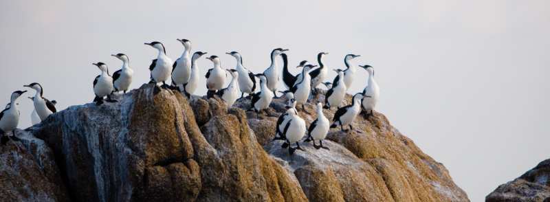
So silent are we that paddling within a few metres of Promise Rock, a protected sea bird rookery off Hazards Beach, six lipstick-lipped Pacific Gulls simply return our gaze, seemingly convinced that we’re pieces of brightly coloured driftwood.
We’re non-polluting, which is just as well given Tasmania’s reputation for having the cleanest air in the world.
We don’t even leave any footprints: our wake just closes behind us, removing all traces of our passage.
It’s almost as if we’ve become part of the seascape and gone is the illusion, at least temporarily, that we’re separate from the natural world.
Schouten Island
We’ve had a couple of days of paddling practice when we leave the relative safety of the shore and head for Schouten Island.
Like the dot of a natural exclamation mark, Schouten (named after Dutch commander Schouten, the first person to sail around Cape Horn, in 1610) lies at the southern tip of Freycinet Peninsula, 22km from the township of Coles Bay, far from Wineglass Bay and separated from the mainland by the treacherous Schouten Passage.
It’s calm when we start paddling the four-kilometre stretch of open water between us and the island, but as the water blackens and the wind whips the sea into busy crests, a side swell begins to rock us with every stroke.
I think about the real possibility of seeing dolphins, seals or even whales at too-close quarters out here.
Then, as we paddle for an hour into the now-howling headwind racing an approaching storm, I think about how vulnerable we are.
When there’s just 3mm between you and the Southern Ocean – and with water temps dawdling around 16ºC even in summer that’s as close as you want to get – you’re at the mercy of whatever nature throws at you.
That night, camped on the island’s northern shore at Moreys Bay with the storm in full swing I almost feel shipwrecked.
There’s a saying in Tasmania: if you don’t like the weather, just wait a minute.
So we’re not surprised when the next morning brings clear skies for our anticipated scramble up nearby Bear Hill. And there, standing atop bare granite boulders 299 metres above sea level, we get the big picture again.
The entire peninsula is spread out before us like a 3D Google map: the beaches we’d camped on, the bays we’d paddled, even some of the walking tracks we’d taken.
A few days ago, I could barely paddle in a straight line.
Now it feels completely natural to stand on an uninhabited island, our trusty kayaks the only way of leaving.
And as we head for home on our last day, it seems as if we’ve travelled further than the 60-odd kilometres we’ve paddled, to the very heart of Freycinet National Park.
Freycinet Peninsula – 3-hour Paddle
By Steve McKenna
With my hands wrapped tightly around an oar, I ask my guide a question that’s been bugging me ever since we put on our wetsuits.
“So Matt, do I paddle right first, or left? It’s important I get this right if we want to go forward, isn’t it?”
Kayaking has never been my strong point – indeed the last time I tried it I toppled over into the path of a sinister-looking stingray in Fiji – so I’m doubly keen to ensure I do things properly today, especially considering the conditions.
The skies are dreary, there’s drizzle in the air and the bluey-green waters of Great Oyster Bay – a sheltered bay hugging Tasmania’s Freycinet Peninsula – are looking decidedly choppy.
All in all, everything looks set up for another capsizing.
But Matt is having none of it – not least because he’s sharing the kayak with me.
“Don’t worry,” he insists. “It’s not the calmest it’s ever been out there, but it’s quite safe – and yes, it probably would be best to paddle right first. That means we’ll go forward not back.”
Reassured by his pep-talk, I begin this three-hour ‘Freycinet Paddle’ adventure (run by local family-run operator, Freycinet Adventures) by negotiating our way from the shore of the township of Coles Bay.
Matt, meanwhile, expertly steers the course using the nifty little foot pedals tucked inside the kayak.
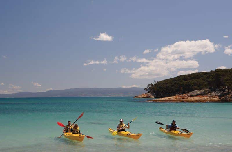
The two other pairs in our group – a 30-something couple from the Hunter Valley and a husband and wife team from Canberra in their late 50s – look like they’ve done this before.
Within two minutes, I decide that this kayaking lark is not that hard at all – although Matt reckons I’m still a work in progress.
“You’re not doing too badly; your right side is OK, but you’re left needs improving,” he says, diplomatically.
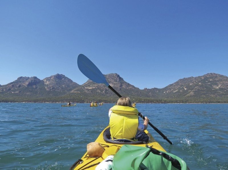
“At least you can paddle, though. I had two AFL players from Hawthorn in my group and they capsized. They may be good at footy, but they couldn’t kayak to save their lives.”
Determined not to suffer the same embarrassment, I knuckle down and try to hone my technique. But it’s hard to concentrate, especially in an environment like this.
Wineglass Bay may be the big noise in this part of the world, but that’s on the other (eastern) side of the Freycinet Peninsula.
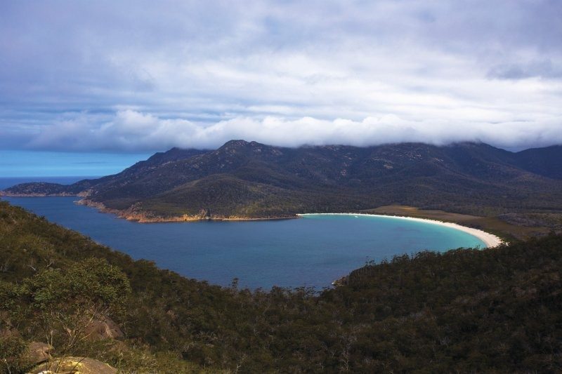
Where I’m sitting, you can’t fail to be entranced by the row of jagged granite outcrops looming in the distance.
Known as the Hazards, these striking lumps rise to 300m high, dominating the skyline for kilometres, and are said to change colour depending on the weather.
They’re a pink or red shade when it’s nice and bright, caused by iron oxide impurities in feldspar, which is a component of granite.
Today, with the sun tucked safely behind the clouds and showing no signs of appearing, the colour has been drained from the Hazards.
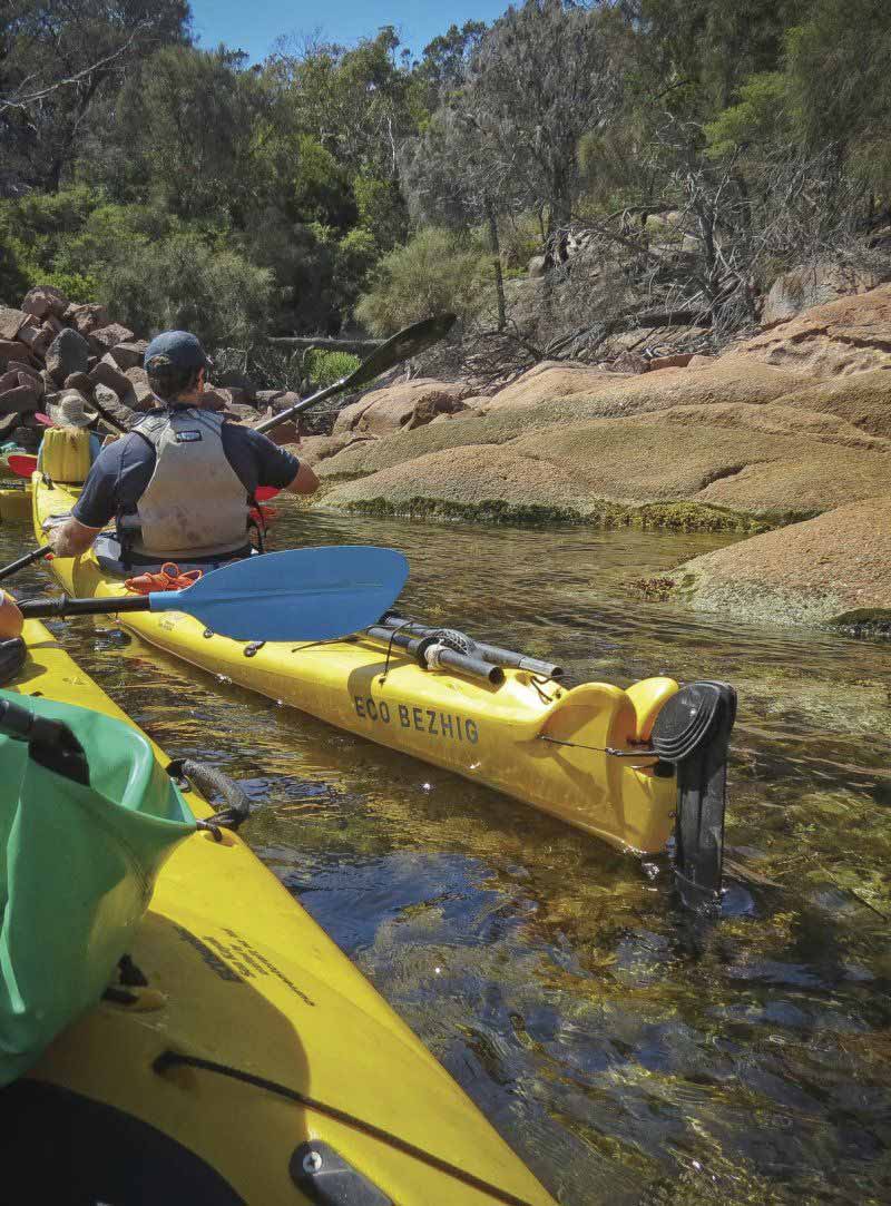
Despite their morose brown appearance, they still stand out; mainly because of the pancake-flatness of much of the surrounding land.
Whenever I cast my eyes anywhere else – like, let’s say, on my kayaking efforts – I’m constantly drawn back to the Hazards.
Freycinet Kayak Tours
Freycinet Adventures runs all-inclusive four-day sea kayaking expeditions between December and April. Everything is provided: kayaks, safety equipment, camping and paddling gear (including lifejackets, spray decks and dry bags), National Park fees, great meals and the company of experienced guides.
Freycinet Adventures also runs 3-hour Freycinet Paddle trips and 2-day Ultimate Weekender trips.
Plan Your Trip
Rent A Car – Find the best car rental rates at Discover Cars. They compare car hire companies to provide you with the best deal right now.
Find A Hotel – If you’re curious about this article and are looking for somewhere to stay, take a look at these amazing hotels.
